The Mill and Mill Inn, Sax Rd, Framlingham - History

This page is a work in progress, currently collecting a jumble memories and records of this mill and Inn lying a about five hundred yards beyond the eastern edge of Fram in the late 19th century.

Ordnance Survey maps

Courtesy of the National Library of Scotland (their originals can be accessed by clicking on each map):

1883:
Mill Inn, East Framlingham, 1883
1903:
Mill Inn, East Framlingham, 1903
1925:
Mill Inn, East Framlingham, 1925
1948:
Mill Inn, East Framlingham, 1948

Note that the buildings in 1948 Pageant Place are post-war pre-fab homes, which were replaced by council houses later.

As can be seen from the above maps, in the C19 Fram used to end where Haynings Farm stands opposite Jeaffreson's Well and the Saxmundham Road starts, as shown in the 1896 photo below. The Sax Rd can be seen receding into the distance and the Mill Inn was in a little group with the mill, all out on their own just round the bend at the furthest point that you can see below. Actually, the mill and associated buildings could be more directly accessed via the track beyond the gate visible to the left of Jeaffreson's Well, diagonally across what is now the Pageant Field, as can be seen on the 1883 and 1903 maps above. It can be seen that this forms a straight run with Castle Street then continues diagonally over the next field to join with Old Way. Old Way is the wide track that tees north off the Sax Rd after the last house in Fram (no. 49). It is indeed very old, it was already called Old Way in 1547.
Jeaffreson's Well with Sax Rd beyond
Photo courtesy of Framlingham Historical Photo Archive


From CAMRA page for Mill Inn, Framlingham (accessed 5 Sep 2020)
"In Liquidation, The Mill Inn, Framlingham, to sell by auction, as interacted by the Trustees of the Estate of M D R DEEKS; also a post wind-mill fitted with iron shaft patent sails, self winding gear & brick roundhouse."
Ipswich Journal, January 4th 1879**

Landlords

The CAMRA page (wrongly) concludes that:

"The Mill is shown at this location on the 1883 OS map. By the 1888 sheet it's gone and appears to have been demolished, so must have closed between those dates."

Location of The Old Mill Inn, FramlinghamThis seems to imply that the author of the CAMRA page (wrongly) thought that the label 'Mill Inn' on the 1883 map pointed to its right, not its left.
On the right, there was a little rectangle in the orchard south of the road (OS no. 300) that disappeared on maps later than 1883. However, this is blue on the coloured print of the 1883 map, telling us that it is a pond. The Mill Inn was definitely to the left of the label.

Nonetheless, it does seem that it was no longer an inn after its demise in 1879, given the OS maps only label it as the "Mill Inn (B.H.)" in 1883 (BH stood for Beer House), and no label at all from 1903 onwards (but that's only weak evidence).

The site of the long-closed Inn is now (2020) the second from last semi-detached houses on the Sax Rd (no's 45 & 47) out of Fram (postcode IP13 9BZ), on the very outskirts of Fram, as shown here.


Plan of Mill and Mill Inn extracted from Conveyance of 3 Sep 1880Deeds and records

An 1880 conveyance from Charlotte Garrett to EWC Jeaffreson contains a plan of the Mill Inn, and the Mill behind, plus outbuildings.

In the writing, it says there's a cottage in the plot where it says "J Smith" (i.e. where Fuller's Cottages were before they were demolished for 49). The sale includes "...the stones and weights ropes sails tackle going gear machinery and appurtenances to the said Windmill..."

The conveyance says that Mrs Garrett had repossessed the property, because the previous owner, Henry Whatling, had not honoured his agreement to repay the £400 mortgage plus £62/14/10d interest that he had borrowed from her to buy the plot (it actually started out as £300, then she lent him another £100 later). In 1879 she had tried to sell the property at auction (see below) but no bid was adequate. Then Jeaffreson bought it a year later for £450. His address is given as Viktoriastrasse 8, Saarbrücken 3, Germany.


Extract from Particulars of the Mill Inn Auction, 11 Jan 1879The auction particulars are really informative. It is described as a 
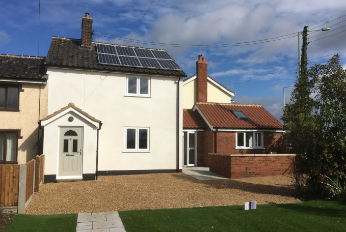
liquidation sale and it says the Mill Inn had 5 chambers, so it would have taken up the whole of Mill House (47) and 45 Sax Rd (previously I had incorrectly guessed that the Inn was just the front part where the tap room is). Presumably the water supply it mentions was the well that is now under 49.


32yrs later (1912) Arthur Larter (Isaac's father, my great great grandfather up the male line on my mum's side) bought the site from EWC Jeaffreson (conveyance here) along with the meadow behind (where the allotments are now). By this point the Windmill had been demolished.


Extract from Sarah Larter's Tenancy Agreement for Mill House, 20 Jan 1923Arthur died 10 years later (14 May 1922) leaving his widow Sarah (my great great grandmother) in Mill House. I've found her tenancy agreement with Arthur's executors as landlords dated the next year, which is allowing the existing tenant to stay in the front part (roughly 45) while Sarah continues to live in the back portion (Mill House) for her lifetime. The tenant (a retired PC) also used the meadow behind.

Sarah Larter née ClaytonSarah Larter (photo left, taken outside Mill House) died 29 Jul 1939, and Gloria Lane, who lived in Home Farm at that time told us that Sarah was a live-in housekeeper for someone, but Isaac Larter gave her a room in Home Farm for her things. So I assume, some time before her death, she moved out of Mill House and became someone else's housekeeper, presumably both for income and companionship.

After Sarah's death, the executors of Arthur's estate put up Mill House and the meadow behind for auction on 1 Sep 1939. Arthur's son, Isaac, won the bidding at £555 to keep it in the family. I need to dig into Arthur's will to find out why it was put up for sale, when his son clearly wanted it.

John Larter has told me in the past that Arthur moved in to Rookery Farm in 1897, and I've found that Isaac's first tenancy of Oak Farm was joint with his father, Arthur, in 1900. So I imagine Arthur and Sarah retired to Mill House when they bought it in 1912.

Isaac went on to buy Moat Farm in 1916, and Oak Farm in 1920 (where Isaac lived and Jack (JC Larter, Isaac's son, my grandfather) had been born on 8 Jan 1905). But that's the start of another story I'll tell later.

Memories

My Nan on my father's side (Norah Briscoe) lived in no. 45 from about 1983 until she briefly went into a home in 1996. Incidentally, she had a rather ignominious past:
    https://en.wikipedia.org/wiki/Norah_Briscoe
Before that I remember Ernie Smith living there, one of the farm workers. I have some photos in my Mum's albums of these people, probably with the cottage in the background - I'll try to dig them out.

After my grandad Jack Larter died in 1975, Vera Green, his live-in housekeeper, moved into Mill House (no.47 behind no.45), until she went to Mills Meadows care home in the mid 1990s, where she died in 2008(?). In the 1960s Horace (Horrie) Green (Vera's father) had lived in Mill House, but his daughter Vera had lived in as housekeeper at Home Farm Parham since 1943 and before that at Sandpit Farm, Bruisyard. In the late C19 and early C20, various of my relatives lived in Mill House, including relatives of my great-grandmother Amy Harvey.

Gordon Fuller's family lived 2 doors up at no. 51. He continued there with his family of twelve, until the late 1980s / early 90s, when his family would have been there for about 100 years. I got this from my cousin, Lyndsay Gooch, who lived in no.51 briefly before 49&51 were demolished in 1998/9 and rebuilt as the single detached house (no. 49) you see today (2025).

The Mill Inn has a reputation as a 'house of ill repute' according to local knowledge. Geoff Rogers tells me that he and other farmworkers were renovating no 45 after Ernie Smith died (Ernie was a retired farmworker) probably around 1983 before my Nan was moved in there. They found thin flexible bell wire in the ceiling, leading from one of the bedrooms down to the tap room. Geoff says they jumped to the conclusion that it could have been a brothel, but an elderly neighbour (who he thinks might have been Gordon Fuller, but he's not sure) told them that it had indeed been known as a knocking shop. That renovation would have been some 100 years after the Mill Inn's demise in 1879, so this memory of the place as a knocking shop must have survived three or four generations.

A brief survey of the history of Victorian prostitution tells me that the growth in the trade arose primarily due to the tremendous shift from rural to urban life, because the rapid population churn in the large cities afforded anonymity to those who wanted it. So social pressure could no longer be exerted like it was in rural towns and villages, where everyone knew everyone and their family and relatives. If the Mill Inn was indeed a house of ill-repute, I'm sure historians of the trade would be interested to know of this example on the outskirts of a sleepy rural Suffolk town.

Records of the Fields around Mill House and the Mill

I've uploaded old deeds and maps of the fields around the Inn here.
   
You can read on the deeds linked above that the mill was built in 1801 by William Titshall, and it goes on to give the buyings and sellings (I haven't fully transcribed it all - ran out of time).

The mill was further back from the road (beyond the top of the photo below), shown as the round building on the 1883 OS map above, exactly where the Mill Place bungalow stands today.
It was common to have a bakehouse and inn together, the yeast from the brew being used for the bread, with the flour from the mill, of course. In the 1870s, the Mill Inn had 5 chambers, taking up all of no's 47 & 45. So it's likely that there was also a bakehouse somewhere within the premises.

There was an orchard over the road, which possibly went with the inn, as shown on the 1883 OS map at the top of this page. It's OS no. 300 on this map:
Fram Corner Transfer Map (1968)
The Mill Inn and Mill House are shown between the left-hand part of 302, where the mill stood, and the right-hand part of 302, where no's 49 & 51 stood.

Late C20 and C21 Records

On the northern side of the main road, opposite the orchard, there were allotments in the corner of the field nearest no 51 in my Grandfather's day. However, there is no record of them on the 1957 Ordnance Survey.

This aerial photo shows no.45 in 1990 (110 years after the inn was closed).
45 Saxmundham Road, Framlingham, Aerial Photo (1990)

It's the one behind the red tin roofs; not the two semi-detached cottages on the right (which are 49 & 51, now demolished and replaced with 49); and not the one behind (47), which is Mill House.

The floor plan until 2019, when we started renovated it, was like this (North points roughly downwards):
45 Sax Rd Pre-2018 Renovation

The long thin 'Kitchen' as shown on the plan used to be the tap room, with a hatch from the 'living room'. Geoff Rogers used to work on our farm, and helped renovate this cottage in about 1983 after Ernie Smith lived here and before my Nan moved in. He tells me that the floor of this room sloped towards a gulley along its length. Here's a photo from a couple of years ago:
45 Sax Rd kitchen before removal, May 2019
I suspect the privvy was in the red brick 'store room', where we found a soil pipe cut-off at floor level feeding a sewerage drain.

Here's what it looks like after renovation in 2019:
Old Mill Inn: Renovation complete, Oct 2020

I'm afraid we didn't find anything interesting in the walls during the renovation (no bell pulls or anything reminiscent of its days as the knocking shop). We've left the flint walls that were along the back and side of the tap room, but covered them over with lining.
Here's the 2018-19 renovation in progress:
    https://drive.google.com/drive/folders/1aYe-YAQZ63S9TYrEZLAC7nFunzxl3Qs6


Bob Briscoe
11 Oct 2020
Rearranged and corrected: 21 Jan 2024
Further corrections and additions 27 Aug 2025